Home / Farm weather / Methodology

How this board works

Every number on the farm weather board can be traced to a public, verifiable source. This page walks through the full path — where the data comes from, how we turn it into advice, and what its limits are.

The path, in five steps

From a city name to a farming recommendation — what happens each time the board loads.
1

You choose a hub

Each of the 21 hubs is mapped to verified coordinates and one of six agro-ecological zones — because advice that fits the Shabelle valley can fail on the Bay plateau.

2

Live weather is fetched

Your browser calls Open-Meteo, which blends ECMWF and national weather models (≈10–25 km grid, updated hourly): current conditions, a 7-day forecast and the past 30 days of rainfall.

3

River flow is checked

For the 16 hubs on the Juba and Shabelle, a second call fetches the GloFAS river-discharge forecast for that hub’s stretch of river and compares it against 10 years of history.

4

Calendars are applied

A knowledge base compiled from FAO GIEWS, FAO SWALIM and FSNAU publications supplies each zone’s seasons, crops and planting windows. This part is expert-verified, not live-generated.

5

Advice is written by rules

Fixed, transparent rules combine the live numbers with the calendar — no black box. Every sentence on the board traces to a rule plus a number you can see.

Example rules

• A planting window is Open when the current month falls inside the zone’s FAO/FSNAU window.
• If a rainfed hub has received under 40 mm in 30 days and expects under 20 mm in the next 7, the board says wait for the rains to establish — planting into dry soil wastes seed.
• If forecast river flow exceeds the 80th percentile of its own 10-year history, the board flags high river flow; above the 95th percentile, very high.

The river-flood signal, in detail

The part we are most often asked about — and the part most platforms get wrong.

Finding the river

GloFAS models river discharge on a ≈5 km grid. A town’s centre often sits off the river channel, where the model reports almost no flow — so for each riverine hub we scanned the surrounding grid and locked the query to the cell that actually carries the river. Jowhar’s signal, for example, comes from the Shabelle channel cell at 2.73°N 45.45°E, not from the town centre.

Deciding what “high” means

A flow of 600 m³/s means nothing without context — normal for the Juba, exceptional for the Shabelle. So for every hub we pulled the full daily discharge record for 2015–2025 (≈4,000 days per reach) and computed that reach’s own 80th and 95th percentiles. “High” on this board always means high for that specific stretch of river, measured against its own decade of history.

Six zones, twenty-one hubs

Somalia is not one farming system. Each hub on the board is treated according to its agro-ecological zone — its own seasons, crops and water source.

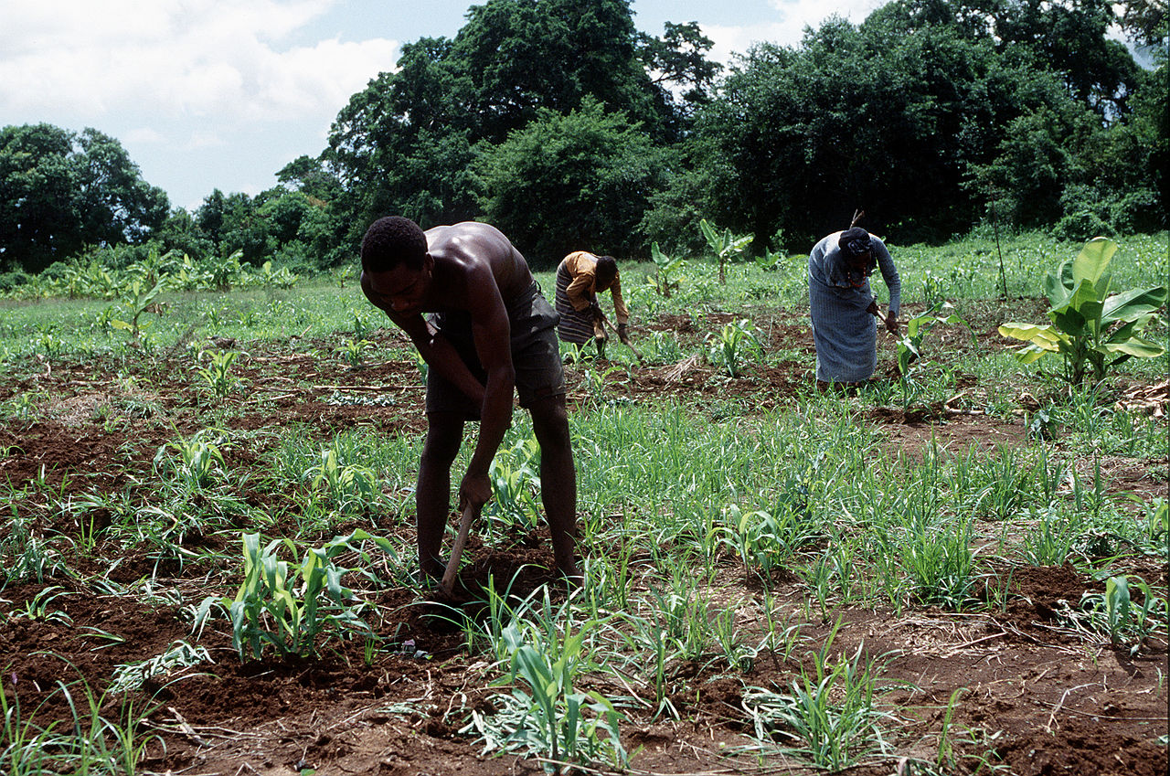
Riverine — Shabelle & Juba valleys (irrigated)

Canal & pump irrigated
AfgooyeJowharBalcadQoryooleyJanaaleShalamboodBuulo MareerMercaJamaameJilibBu'aale
Seasons & crops: Gu (Apr–Jun) & Deyr (Oct–Dec), plus irrigated dry-season horticulture
Water: Canal and pump irrigation along the Shabelle and Juba rivers

Coastal peri-urban — Banaadir

Wells & coastal rains
Mogadishu
Seasons & crops: Market vegetables Oct–Feb; maize and cowpea in Gu & Deyr
Water: Shallow wells and coastal rains around the capital

Rainfed inter-riverine — the sorghum belt

Rainfed only
BaidoaWanlaweyn
Seasons & crops: Gu (Apr–Jun) & Deyr (Oct–Dec), fully rainfed
Water: No river — planting follows the rains only

River recession — Hiran (Shabelle)

Flood recession
BeledweyneBulo Burto
Seasons & crops: Gu & Deyr grains, plus recession crops planted as flood water recedes
Water: Riverbank moisture left behind after seasonal river peaks

Northwest highlands — Awdal & Maroodi Jeex

Rain, springs & wells
GebileyBorama
Seasons & crops: One long season: Gu (Apr–Jun) into Karan (Jul–Sep), harvest Oct–Nov
Water: Higher-altitude rainfall plus springs and shallow wells

Juba pump irrigation — Gedo

Pump irrigated
BarderaLuuqDollow
Seasons & crops: Grains in Gu & Deyr; onions and vegetables Oct–Feb
Water: Motor pumps lifting Juba river water in an otherwise arid zone

What this board is not

Honesty is part of the methodology. Four limits every serious reader should know.

Models, not rain gauges

Somalia’s ground-station network is sparse, so weather values are model estimates — excellent for patterns and trends, but a specific field’s rainfall can differ from the grid average.

A flood signal, not a flood forecast

High modelled flow means statistically unusual water volumes. Whether a bank actually breaks depends on embankments, siltation and upstream breaches — things no global model sees. Treat the flag as a reason for vigilance, and follow SWALIM flood advisories.

Zone-level, not field-level

Planting windows are compiled at zone level from FAO and FSNAU calendars. Soil, seed variety and local micro-climate can shift the right date on any given farm — which is why the board hedges rather than commands.

A window into the real service

This public board is in English for partners and visitors. Farmers receive the operational advisory in Somali — by USSD, SMS and voice on basic phones — through the M-Tacab platform itself.

Sources

Open-Meteo — live weather, forecasts and 30-day rainfall history (ECMWF and national models)
GloFAS via Open-Meteo Flood API — river discharge, Copernicus Emergency Management Service
FAO GIEWS — Somalia country brief — seasonal calendar and crop production context
FAO SWALIM — Somalia water and land information, flood monitoring reference
FSNAU — seasonal monitors and agricultural methodology
FAO Crop Calendar — crop planting and harvesting windows

The same engine, on a basic phone.

This board is the public face of the advisory M-Tacab runs for 243,824 subscribers in Somali — localised, season-aware and delivered over USSD, SMS and voice.

Back to the live board  Partner with us
Figures reflect M-Tacab's live platform (June 2026). Modules tagged “Ready to deploy” are built and activated when a partner commits.